Reactions: 7.8-magnitude quake in Turkey leaves thousands dead
Early this morning, an earthquake with a magnitude of 7.8 struck southeastern Turkey and northern Syria. The authorities have reported thousands of deaths and extensive material damage. A second earthquake has occurred further north than the previous one.
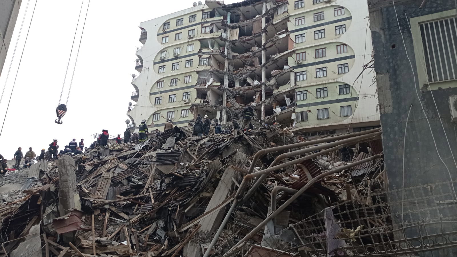
Emergency workers search for victims at the site of a collapsed building in Diyarbakir, southeastern Turkey, after the earthquake. EFE/EPA/DENIZ TEKIN.
José Morales - terremoto Turquía EN
José Morales
Professor of Earth Physics at the Andalusian Institute of Geophysics and the University of Granada
The earthquake had a magnitude of Mw=7.7-7.8. It occurred on what is known as the East Anatolian Fault (EAF); the reports I have seen indicate this origin. This fault and its segments are about 700 kilometres long; it is a major fault that has seen destructive earthquakes in the past. This fault accommodates the deformation that occurs between the Arabian and Eurasian plate as a result of the northward movement of the Arabian plate. The other major fault in Turkey is the North Anatolian Fault (NAF) which was also responsible for large earthquakes, such as the 1999 Izmit earthquake of Mw=7.4. Today's earthquake is bigger and is one of the largest ever experienced in that region (Turkey/Syria).
As far as the damage is concerned, I can’t say much yet, but the number of victims will undoubtedly be high. We can see buildings completely collapsed. There, as in Izmit, the vulnerability of the buildings and their seismic resistance is crucial to the damage.
[About the second earthquake] This second earthquake is further north and must have been triggered by the first one. The first data indicate that it is a different structure than the East Anatolian Fault. Now the investigation begins to see the connections between the two.
Galderic Lastras - terremoto Turquía EN
Galderic Lastras
Geologist and professor at the Faculty of Earth Sciences, University of Barcelona
The earthquake had a magnitude of 7.8 and its hypocentre was located at a depth of about 18 kilometres, which is relatively shallow for an earthquake of this magnitude. In general, the shallower the depth, the greater the intensity felt at the ground surface, and the greater its effects on the population.
According to the analysis available from the U.S. Geoological Survey (USGS), the rupture occurred over more than a hundred kilometres on one or more vertical, directionally moving, SW-NE oriented faults, most likely in the eastern Anatolian fault zone, with cumulative displacements of up to 3 metres along the fault. (It should be remembered that, although an earthquake is symbolised by a dot on a map, this only represents the point at which a larger rupture has been initiated along a given fault plane.)
This fault zone connects the Arabian plate and the Anatolian subplate. This is the largest instrumentally recorded earthquake on this fault zone, although the Aleppo earthquakes of 1138 (estimated magnitude 7.1) and 1822 (estimated magnitude 7.0) have been historically documented. The main earthquake was followed, as usual, by numerous aftershocks, the largest of which occurred 11 minutes later with a magnitude of 6.7. While other large aftershocks could occur in the short term, their frequency and magnitude are expected to decrease over time.
According to USGS loss estimation models (based on recorded intensities and characteristics of the area) the damage that could have occurred is very substantial. Natural hazard is the product of the probability of the occurrence of a potentially damaging natural mechanism and the expected damage. The expected damage depends on the exposed elements (population, buildings, infrastructure, etc.) and their vulnerability. In this geographical border area, which already has a high probability of high-magnitude earthquakes, there are several factors that increase vulnerability, such as the presence of an additional population displaced by the war in Syria, living in unsafe constructions and with enormous difficulties in covering their most basic needs. Very often, conflicts with displaced populations increase the damage of natural disasters, and unfortunately this is a clear example.
Elisa Buforn - terremoto Turquía EN
Elisa Buforn Peiró
Retired professor of Geophysics and Meterorology in the Department of Earth Physics and Astrophysics at the Complutense University of Madrid.
The 6 February earthquake, with a magnitude Mw=7.8, occurred at a plate boundary. That’s where the accumulation of stresses resulting from the movement of the plates is released in the form of earthquakes. The magnitude of the Turkey earthquake and its shallow centre, about 17 km according to the U.S. Geological Survey, suggest a high potential for destruction.
Earthquakes are natural events that cannot be predicted or avoided, so the key is prevention in order to mitigate and minimise damage as much as possible. Seismic-resistant codes or standards, together with Early Earthquake Warning Systems (EEWS), are two of the most effective tools for dealing with these natural events, and that’s where society's efforts should be directed.
María José Jurado - terremoto Turquía EN
María José Jurado
Researcher at Geosciences Barcelona (GEO3BCN - CSIC)
Converging plate boundary zones often record seismic activity related to movement and displacement along faults and fault zones close to plate contacts. The area affected by the earthquake is in the contact zone between 4 plates and microplates. The geological context is particularly complex and therefore fault displacements and movements are frequent as a result of the convergence between these large blocks (plates). The Anatolian (NE), Arabian (S-SE), Eurasian (NW) and Nubian (SW) plates converge in the earthquake zone.
The first earthquake of magnitude 7.8 was generated by the movement of a so-called rifting or jumping fault that would be framed by the eastern Anatolian fault zone that accommodates deformation between the Anatolian, Arabian and African plates.
The second major earthquake has been somewhat shallower (hypocentre or focus of the earthquake located at a depth of 10 km) than the first one (at a depth of 17.9 km).
