The global population exposed to fires has increased by 40% in twenty years
A US team has analyzed the evolution of the global population exposed to forest fires between 2002 and 2021. The study indicates that the number of people exposed has increased by 40%, despite a 26% reduction in the area burned. This is mainly due to the increase in the population living in urban-forest interfaces. 85% of exposures occurred in Africa, even though forest fire disasters in North America, Europe, and Oceania have received most of the attention, notes the study, which is published in the journal Science.
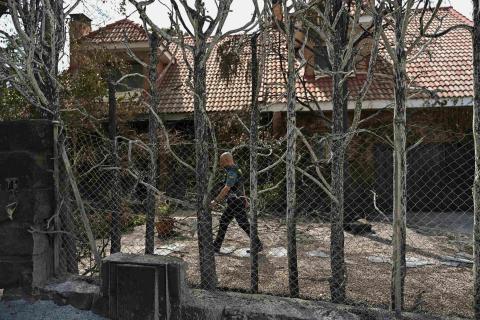
A neighbor among the burned houses in the village of San Vicente, this Monday in Vilamartín de Valdeorras (Ourense). EFE/ Brais Lorenzo.
Víctor F - Exposición (T)
Víctor Fernández-García
Lecturer in the Department of Engineering and Agricultural Sciences at the University of León
The article presents high-quality work carried out by renowned authors in the field of large-scale fire analysis. The study uses global fire and population density data with moderate spatial resolution, which is common in this type of global approach. The research question is relevant, as it seeks to demonstrate how the population's exposure to fires evolves and is spatially distributed. Although there are previous studies on the relationship between burned area and population, the approach is novel in that it focuses on fire exposure and differentiates between the role played by population dynamics on the one hand and changes in fires on the other in the evolution of this exposure between 2002 and 2021. Overall, the article offers robust and well-founded results, considering the limitations inherent in the use of moderate spatial resolution data.
When it comes to global fire analysis, Africa is the main determinant of what happens, as it is the largest contributor to the area burned worldwide (around 70%). In this case, the results show that population exposure to fires is increasing globally, driven mainly by changes in Africa (39.6%), where population dynamics (rather than burned area) explain this pattern. Less robust increases in exposure are also observed in South America and North America, in line with previous studies indicating an expansion of urban-forest interfaces in the US. In contrast, no increases in exposure are detected in Europe and Oceania.
The main novelty of the study lies in demonstrating that there is a global increase in fire exposure and that this increase is mainly due to population growth and redistribution in fire-prone areas. This conclusion has important implications: the risk associated with fires could be increasing even when fire activity is not. If this increase in exposure is associated with an increase in fire-related impacts, this would reinforce the need for preventive measures, primarily landscape management.
The authors themselves acknowledge several limitations of their study. First, they only count the population within the perimeter of the fire as exposed, although the impacts may extend to people nearby or even at great distances (e.g., due to smoke). In addition, it should be noted that the level of impact is not the same for all burned areas. To partially address this issue, the authors include an analysis of more intense fires. This approach also has limitations associated with the spatial and temporal resolution of the data.
Looking ahead, the availability of higher-resolution burned area and severity products (e.g., from the Sentinel-2 satellite) will allow for more accurate estimates of population exposure to fire, especially in regions with small fires or complex fire behavior. Likewise, incorporating more specific metrics, such as damage to homes or pollutant concentration in smoke, could offer a more practical view of whether the impacts of fires on the population are increasing".
Pipo - Exposición (EN)
José V. (Pipo) Roces-Díaz
Professor at the University of Oviedo, researcher at the Joint Institute for Biodiversity Research (IMIB) of the CSIC-University of Oviedo
The changes observed in recent decades, both in the spatial-temporal patterns of forest fires (with a heterogeneous global decrease in the annual area burned) and in various descriptors of their regimes (e.g., the increase in more intense fires), have received growing scientific attention. Added to this are demographic dynamics. At the beginning of this century, for the first time in history, the urban population surpassed the rural population, a milestone with profound implications for land use distribution. This process has simultaneously driven dynamics of abandonment and intensification that are reshaping the composition and structure of landscapes around the world, especially in the urban-forest interface, whose expansion is now unquestionable.
The article by Seydi et al. is a high-quality, impactful contribution precisely because it connects these elements: changes in fires and population, through the analysis of shared patterns and dynamics. It does so using robust data from a broad time series (albeit conditioned by the availability of satellite observations) and with a global perspective. Their results are compelling: since the beginning of the 21st century, the number of people directly exposed to forest fires, particularly those of greater intensity, has continued to grow. This spatial coincidence between fires and human settlements is evident on all continents, although with different magnitudes and explanatory factors. In some regions, population growth has been a determining factor, while in others, climatic factors have predominated.
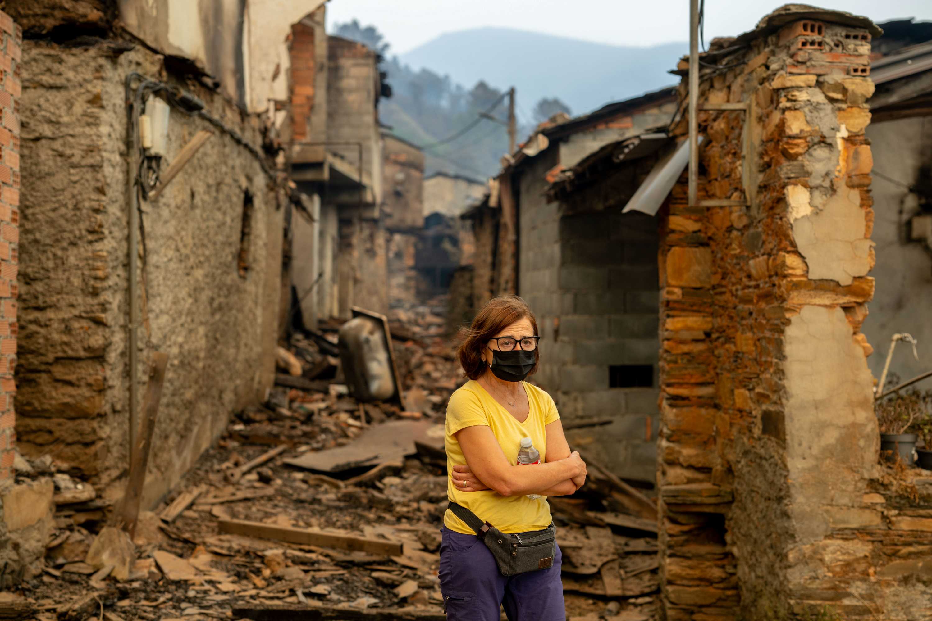
Africa is once again emerging as a global hotspot; however, other densely populated regions (such as the Mediterranean basin and the west coast of North America) have also experienced some of the most damaging episodes in recent decades. These fires, in addition to their serious social, economic, and environmental consequences, have captured international media attention and continue to do so, as evidenced by the serious events recorded in August 2025 in northwestern Spain.
In the current context of global and climate change, having accurate and spatially explicit estimates of risks, such as increasing human exposure to extreme fires, is essential for advancing toward planning and management policies capable of effectively mitigating their impacts on society.
Montiel - Exposición (EN)
Cristina Montiel Molina
Professor of Regional Geographical Analysis and Director of the Research Group 'Forest Geography, Policy and Socioeconomics'
The article has several serious shortcomings. From a conceptual standpoint, it equates exposure with wildland-urban interfaces (WUIs), which is reductionist and inaccurate. Human exposure to fires is much broader and is not limited to these risk areas. Second, it treats WUIs in a generic manner, which is incorrect given the wide variety of cases that exist. Furthermore, it does not even define the general term as used in the article. Thirdly, it treats these areas in the same way and gives them the same meaning across all continents, which is also inaccurate since they are the result of different territorial dynamics, at different times and at different rates.
The article also lacks methodological rigor in its handling of spatial-temporal scales. Nor does it specify the sources of information it uses. The comparative analysis and results it presents are inconsistent. The conclusions lack scientific basis and do not make any serious contributions.
Seydi et al.
- Research article
- Peer reviewed